


In the heart of the Himalayas
Buransh Stays has something to offer every type of adventurer. Whether you're a nature enthusiast, a walker, a photography buff, a birder, a sports lover, or someone eager to explore new cultures, you'll feel right at home here. With its breathtaking mountain vistas and close proximity to key trekking and pilgrimage destinations, Buransh Stays is the perfect place to relax and soak up the beauty of Uttarakhand. Plus, we'll spoil you with scrumptious treats and drinks as you reconnect and rejuvenate.
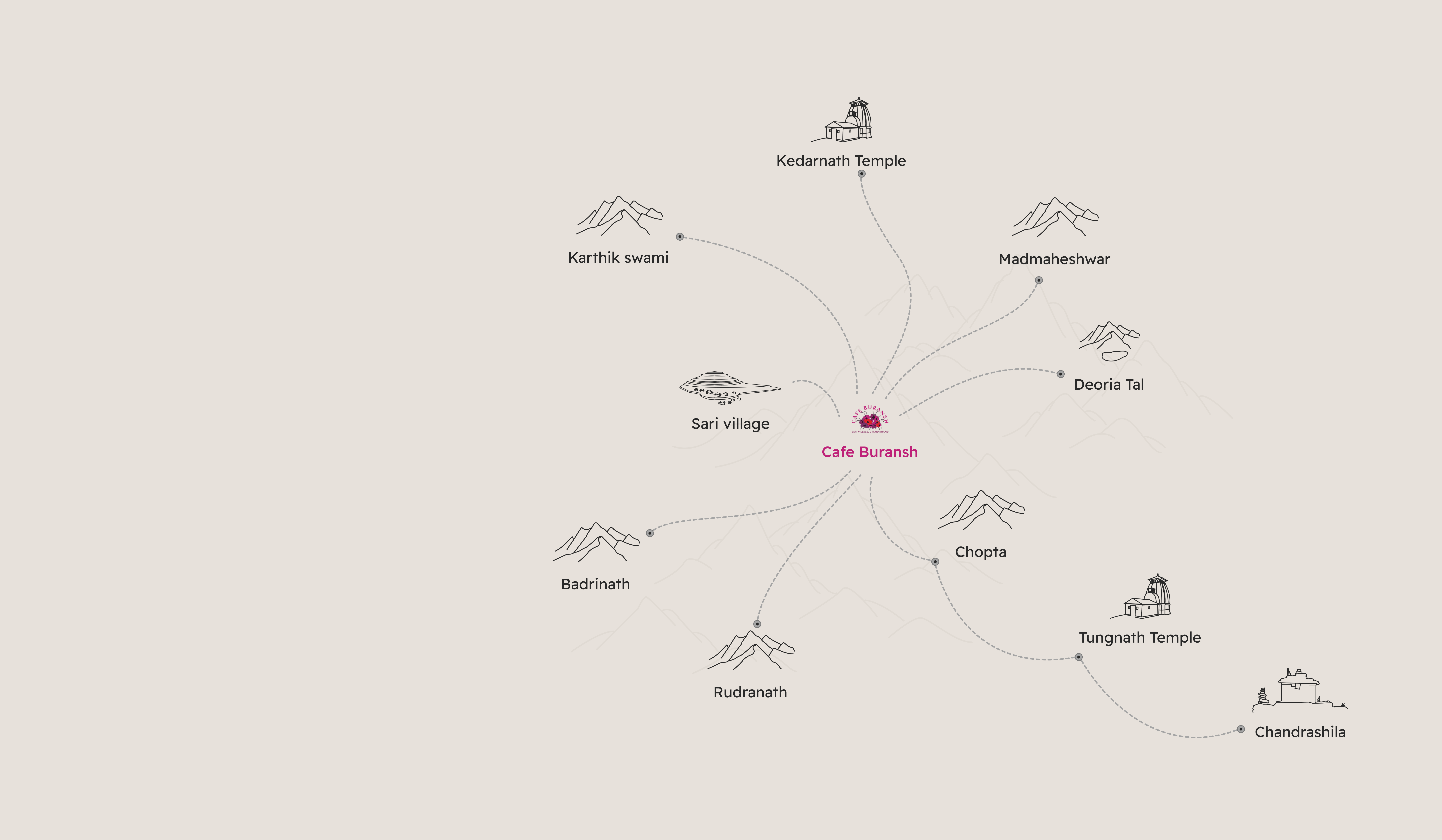
Destinations
Explore the Great outdoors
 Map Direction
Chopta is the land of snow-capped peaks, lush meadows, crystal-clear rivers, and golden sunsets. This region is also a haven for wildlife, including Himalayan Tahr, Musk deer, and over 240 species of both migratory and local birds, including the elusive Monal, our state bird. Chopta is also the base camp for the Tungnath and Chandrashila treks. We recommend spending an entire day exploring this slice of heaven.
 20 kms
 0 kms
0 kms 8800 ft
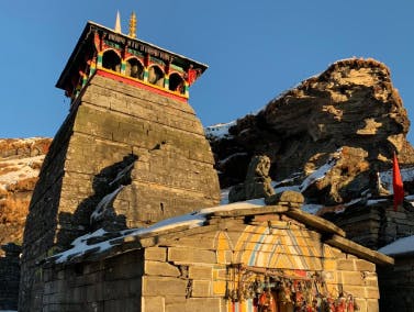 Map Direction
The Tungnath trek is a 4-km ascent from Chopta and offers stunning views of the Himalayas. It is the highest of the five Panch Kedar temples located in the state of Uttarakhand. The temple is perched on a ridge just below the peak of Chandrashila. This is a moderately easy trek that can be completed in about 4-5 hours from Chopta.
20 kms4 kms12100 ft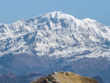 Map Direction
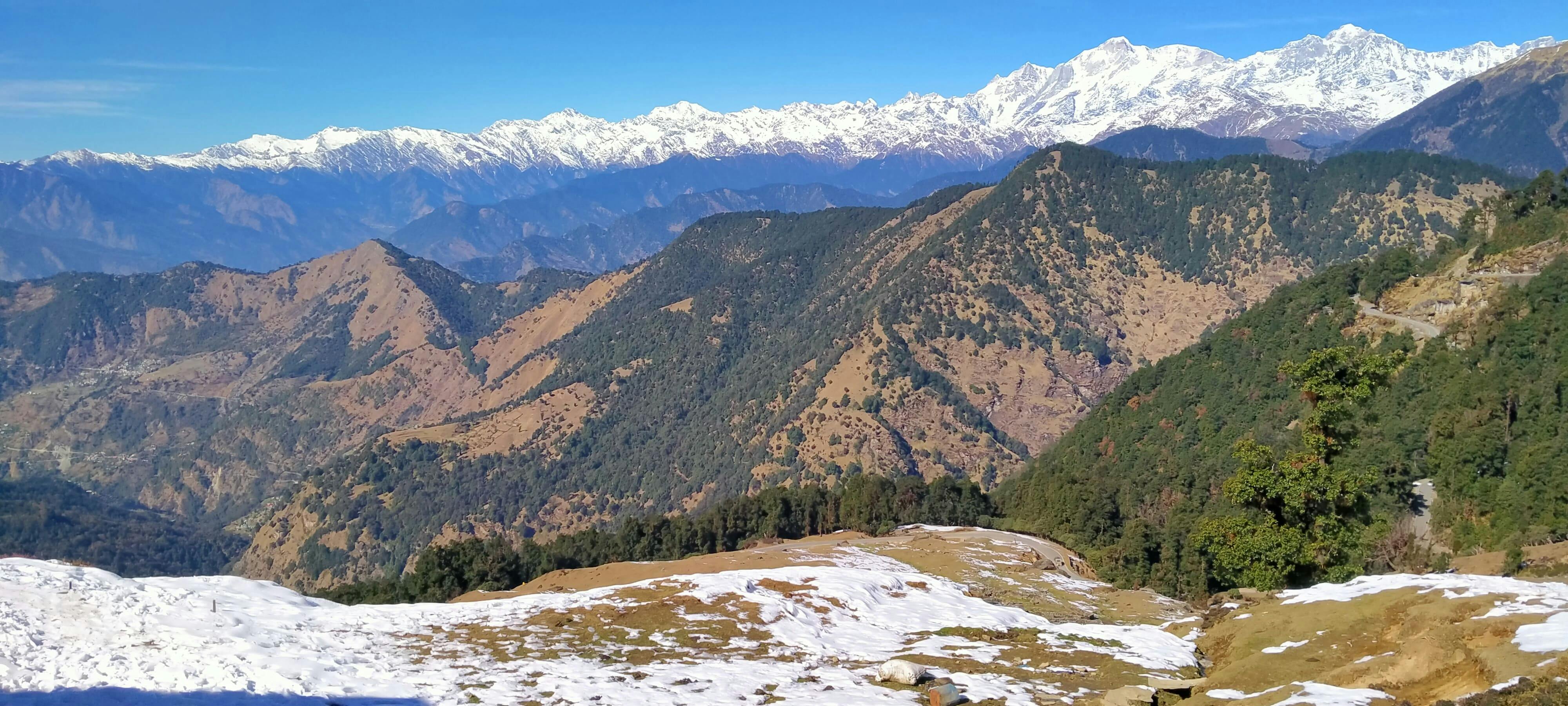
Chandrashila is a challenging and rewarding hike that takes you to the top of a 13000 ft peak. The trek offers stunning views of the surrounding mountains, including Nanda Devi, Trishul, and Kedarnath. Along the way, you will pass through forests of pine, oak, and rhododendron. The views from the peak are simply breathtaking. On a clear day, you can see for miles in every direction.
20 kms5 kms13000 ft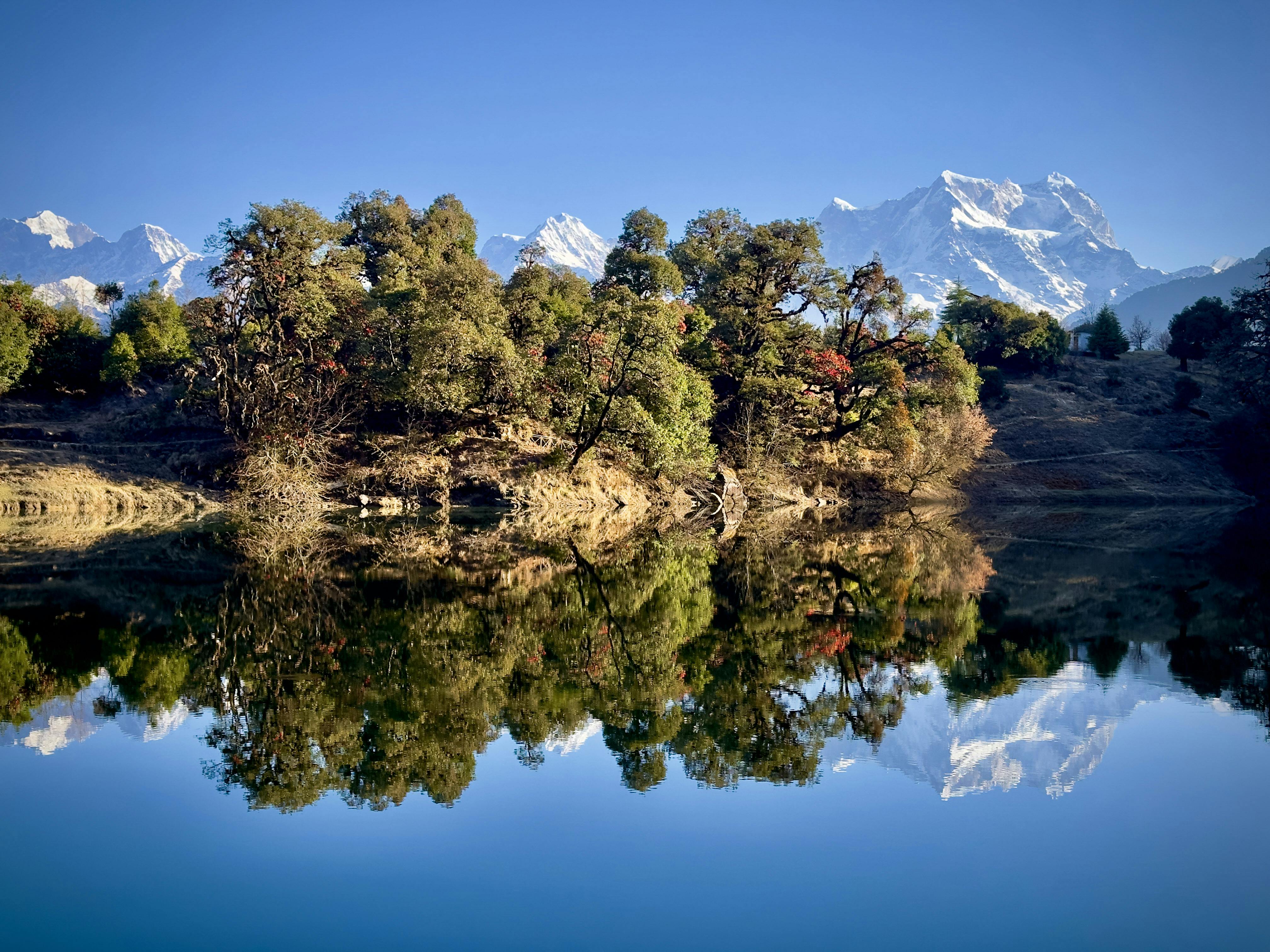 Map Direction
With just a 2-km hike up from us, Deoria Tal is the shortest hike up for the grandest view. Rise early to witness the magic of a sunrise reflection on the still waters, or spend your days simply exploring the surrounding woods. Surrounded by lush greenery and magnificent peaks, Deoria Tal is the perfect spot for meditation, reading, or just lazing around looking at the snow peaks.
0 kms2 kms8000 ft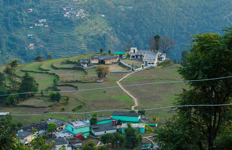 Map Direction
Sari Village is a hidden gem in the Garhwal Himalayas. Nestled among the majestic mountains, our village is fairly untouched by commercialization and is a world away from bustling city life. The rolling green hills, dreamy paths, and quaint structures are sure to take you back in time. Whether you are looking for a cultural experience, a hiking adventure, or simply a place to relax and enjoy the scenery, Sari Village is the perfect destination for you.
0 kms500 mts6600 ft